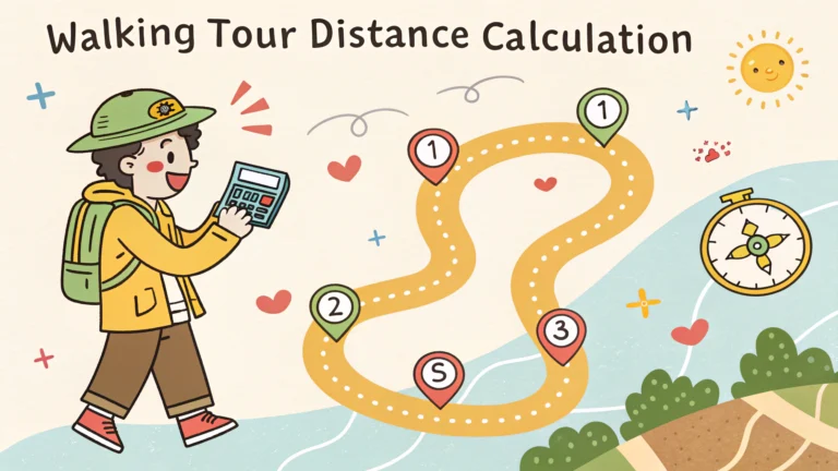
Calculating distances for walking tours requires understanding a few key factors that affect how far people can comfortably walk.
The average walking speed for most adults is about 3-4 miles per hour on flat terrain.
Key Distance Planning Factors
- Fitness level of participants
- Weather conditions
- Terrain difficulty
- Number of stops
- Time available
Recommended Walking Tour Distances by Duration
| Tour Length | Distance | Best For |
|---|---|---|
| 1 hour | 1-2 miles | Quick city highlights |
| 2 hours | 2-3 miles | Neighborhood exploration |
| Half-day | 4-6 miles | In-depth city tours |
Distance Planning Tools
- Google Maps: Plot walking routes and get accurate distances
- Strava: Create custom routes with elevation data
- MapMyWalk: Plan routes with points of interest
Tips for Distance Planning
Add 25% extra time to account for photos, rest stops, and unexpected delays.
Consider including alternate shortcuts or bail-out points for tired walkers.
Place major attractions within the first half of the route when energy levels are highest.
Terrain Adjustment Guidelines
- Steep hills: Reduce planned distance by 30%
- Crowded areas: Account for 20% slower pace
- Rough surfaces: Reduce distance by 15%
Special Considerations
Check accessibility requirements for participants with mobility challenges.
Research bathroom locations and water fountains along the route.
Map out shaded areas for hot weather walking.
Distance Measuring Methods
- Pedometer apps
- GPS tracking devices
- Online mapping tools
- Physical distance wheels
Remember to include buffer time between major stops for route flexibility.
Test the route personally before finalizing the tour distance.
Always have a backup plan for weather changes or unexpected route closures.
Safety and Comfort Considerations
Walking tours should balance distance with participant comfort and safety needs.
- Schedule regular rest stops every mile
- Provide clear meeting points
- Ensure cell phone coverage along route
- Mark safe street crossing locations
Group Management
Larger groups require additional planning considerations for distance management.
Group Size Adjustments
- 10+ people: Reduce pace by 10%
- 20+ people: Add extra rest stops
- 30+ people: Consider splitting into sub-groups
Seasonal Adjustments
Modify distances based on seasonal conditions and daylight hours.
- Summer: Plan early morning or evening walks
- Winter: Shorter routes with indoor options
- Shoulder seasons: Standard distances with weather contingencies
Conclusion
Successful walking tour distance planning requires careful consideration of participant needs, environmental factors, and practical limitations. Regular route assessment and flexibility in planning ensure comfortable and engaging experiences for all participants.
Remember to document successful routes and gather participant feedback for future tour improvements.
Keep routes adaptable and always prioritize participant safety and comfort over distance goals.
FAQs
- What is the average walking distance for a self-guided walking tour?
Most self-guided walking tours cover between 2-5 miles (3.2-8 kilometers), typically taking 2-4 hours to complete at a leisurely pace with stops for sightseeing and photos. - How do I calculate the total distance for planning my walking tour route?
Use digital mapping tools like Google Maps, MapMyWalk, or Komoot to plot your points of interest and calculate the walking distance between them, including detours and return routes. - What is a comfortable walking distance for most people on a tour?
The average person can comfortably walk about 2-3 miles (3.2-4.8 kilometers) without requiring significant rest stops. Seniors or families with children should plan for shorter distances of 1-2 miles. - How much time should I allow per mile when planning a walking tour?
Plan for approximately 20-30 minutes per mile (1.6 km) of actual walking time, plus additional time for stops, photos, and sightseeing – typically 45-60 minutes per mile total. - What tools can I use to measure walking distances accurately?
GPS-enabled devices, smartphone apps like Strava or AllTrails, pedometers, and online mapping services can accurately measure walking distances and help plan routes. - How do elevation changes affect walking tour distances?
Every 100 feet (30.5 meters) of elevation gain typically adds the equivalent of 0.1-0.2 miles to your perceived walking distance in terms of effort and time needed. - What’s the recommended maximum distance for a half-day walking tour?
A half-day walking tour should not exceed 4-5 miles (6.4-8 kilometers) to allow for comfortable pacing, stops, and potential detours while maintaining energy levels. - How can I adjust walking tour distances for different fitness levels?
Include shorter route options and multiple exit points every 1-1.5 miles (1.6-2.4 kilometers) to accommodate different fitness levels and allow participants to customize their experience. - What factors should I consider when calculating tour distances in urban areas?
Account for traffic lights, crosswalks, crowds, and one-way streets which can add 10-25% more distance and time compared to the direct route measurement. - How do weather conditions impact walking tour distances?
Extreme temperatures, rain, or snow can reduce comfortable walking distances by 25-50%; plan shorter routes for challenging weather conditions and include indoor shortcuts or shelter options.