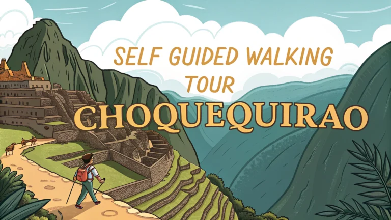
Choquequirao, often called Machu Picchu’s sister city, offers adventurous hikers a chance to explore one of Peru’s most spectacular yet less-visited Incan ruins.
Quick Facts About the Trek
- Distance: 64km (40 miles) round trip
- Duration: 4-5 days recommended
- Difficulty: Challenging
- Elevation: 1,800m to 3,050m
- Best Time: April to October (dry season)
Trail Overview
The trek begins in Cachora, a small town accessible by bus or taxi from Cusco.
Day-by-Day Route
- Day 1: Cachora to Santa Rosa (6-7 hours)
- Day 2: Santa Rosa to Choquequirao (5-6 hours)
- Day 3: Explore Choquequirao ruins
- Day 4: Return journey begins
Essential Preparation Tips
- Book accommodations in Cachora the night before starting
- Purchase entrance tickets in Cachora (65 soles)
- Bring cash – no ATMs on route
- Pack light but bring enough water and snacks
- Consider hiring a mule for luggage (100-150 soles per day)
What to Pack
- Sturdy hiking boots
- Rain gear
- Sleeping bag
- Headlamp
- First-aid kit
- Water purification tablets
Camping Options
Basic campsites are available at Santa Rosa, Marampata, and near the ruins.
Safety Considerations
- Register at the checkpoint in Cachora
- Avoid hiking alone
- Check weather forecasts before departing
- Acclimatize in Cusco for 2-3 days before starting
Contact Information
Emergency Numbers: Police: 105, Tourist Police Cusco: +51 84 249654
Getting There
- Bus from Cusco to Abancay (4 hours)
- Taxi from Abancay to Cachora (2 hours)
Book transport through reputable companies like Cruz del Sur (www.cruzdelsur.com.pe).
Local Guide Services
Contact the Cachora Tourist Information Office (+51 984 798461) for certified local guides.
Alternative Routes
Consider the extended 8-9 day trek that continues to Vilcabamba for experienced hikers.
Photography Tips
- Best light for photos: early morning or late afternoon
- Bring extra batteries – no charging points available
- Protect camera equipment from dust and rain
Wildlife and Flora
The trek offers opportunities to spot Andean condors, spectacled bears, and hummingbirds. The varied vegetation includes orchids, bromeliads, and ancient Polylepis forests.
Cultural Considerations
- Respect local communities along the route
- Support local businesses when possible
- Ask permission before photographing locals
- Learn basic Quechua greetings
Physical Preparation
- Train for steep ascents and descents
- Practice hiking with a loaded backpack
- Focus on cardio exercises before the trek
- Consider altitude training if possible
Archaeological Highlights
Main Features at Choquequirao
- Main Plaza
- Llama Terraces
- Sun Temple
- Priest’s Quarter
- Agricultural Sectors
Conclusion
The Choquequirao trek presents a challenging but rewarding adventure for those seeking to explore one of Peru’s most magnificent Incan sites without the crowds of Machu Picchu. Proper preparation, respect for the environment, and cultural awareness will ensure a memorable experience in this remote archaeological wonder.
Additional Resources
- Choquequirao Archaeological Park website
- Local weather forecasts
- Cusco Tourist Information Center
- Trekking forums and communities
FAQs
- How long does it take to complete the Choquequirao trek?
The complete trek to Choquequirao typically takes 4-5 days round trip from Cachora, covering approximately 64 kilometers (40 miles) total distance. - What is the best time of year to do the Choquequirao trek?
The best time is during the dry season from April to October. Avoid the rainy season (November to March) as trails become muddy and dangerous. - How high is Choquequirao and what altitude sickness precautions should I take?
Choquequirao sits at 3,050 meters (10,010 feet) above sea level. Acclimatize in Cusco for 2-3 days before starting the trek and stay hydrated throughout. - Do I need a guide to visit Choquequirao?
No, a guide is not mandatory. The trail is well-marked and can be done independently, but having a map and good navigation skills is essential. - What camping equipment do I need for the Choquequirao trek?
Essential equipment includes a tent, sleeping bag rated for cold temperatures, camping stove, water filtration system, and sufficient food supplies. - Where can I find water sources along the Choquequirao trail?
Water is available at streams and campsites along the route, particularly at Playa Rosalina, Santa Rosa, and Marampata, but must be treated before drinking. - How physically demanding is the Choquequirao trek?
The trek is considered strenuous with steep ascents and descents, including a 1,800-meter elevation change into and out of the Apurímac Valley. - Are there camping facilities along the Choquequirao trail?
Yes, there are basic camping areas at Santa Rosa, Marampata, and near the archaeological site, with simple toilets and sometimes small shops. - What is the entrance fee for Choquequirao?
The entrance fee is approximately 60 soles (about $17 USD) per person, which can be paid at the checkpoint near the archaeological site. - How different is Choquequirao from Machu Picchu?
Choquequirao is larger than Machu Picchu, receives far fewer visitors, and only about 30% has been excavated. It features unique elements like llama terraces not found at Machu Picchu.